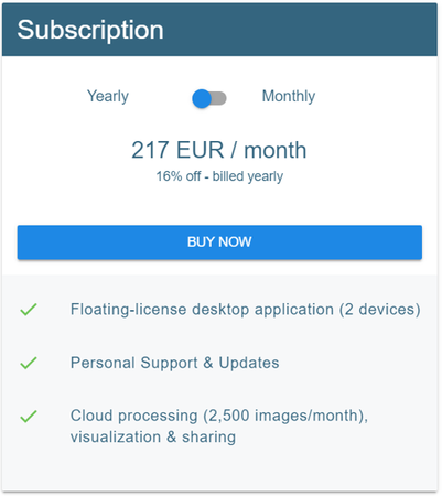
Pix4Dmapper - 12-month license (2 devices)
- Professional photogrammetric programming for 3D mapping and scanning.

Pix4Dmapper
Leading photogrammetric software for professional drone mapping
 |
CaptureCapture RGB, thermal or multispectral images with any camera. If you are using a drone, automate flight and image-data transfer with the free Pix4Dcapture app. |
 |
DigitizePix4Dmapper transforms your images into digital spatial models. Seamlessly process your projects using the desktop photogrammetry software or Pix4Dcloud. |
 |
ControlAssess and improve the quality of your project. The quality report gives a preview of the generated results, calibration details, and many more project quality indicators. |
|
|
Measure & inspectMeasure distances, areas, and volumes.Extract elevation profile data and perform virtual inspections. |
 |
Collaborate & shareStreamline project communication and teamwork. Selectively and securely share project data and insights with your team, clients, and suppliers, with standard file formats or online with Pix4Dcloud. |
A variety of tools to power applications across industries
Desktop & cloud
 |
 |
 |
||
Survey-grade resultsObtain results with sub-centimetre accuracy. |
Complete control over your projectDefine an area of interest, select processing options, add ground control points or edit point clouds, DSMs, meshes, and orthomosaics. |
Your workflow, your choiceUse default templates for automatic processing, or custom settings for full control of quality, data, and projects. Choose when and how to use the cloud and desktop processing. |

rayCloud tm
A unique environment connecting your original images to each point of the 3D reconstruction to visually verify and improve the accuracy of your project.
Accurate 3D maps and models, purely from images
Przedstawiamy kilka z wielu niezwykle przydatnych funkcjonalności:

Automatic point cloud classification - Distinguish objects with machine learning classification processes.

Flatten & smoothen digital surfacese - Create surfaces to improve planarity or fill holes in critical areas.

Easily measure surface, distance, volume & elevation - Measure in 3D with a fully-adjustable base height.

Inspect & Annotate - Remotely inspect projects and accurately pinpoint, highlight and describe critical elements.

Collaborate & Share - Selectively and securely share project data and insights with your team, clients or other stakeholders.
Photos first - Any camera. Any drone. Any imagery. As long as it's a .jpg or a .tif.
• Traditional camera and camera images
• Drone images
• Multispectral images
• Thermal images
• Fisheye images
• 360o camera images
• Camera rig images
• Videos
Your projects. Your tools.
Easily export your digital maps and models to industry-compatible formats for further analysis or reporting.

CFull-color point cloud: .las, .laz, .ply, .xyz

Orthomosaic: GeoTiff (.tif), .kml

Digital surface model (DSM): GeoTiff (.tif), .xyz, .las, .laz

3D textured mesh: .ply, .fbx, .dxf, .obj, .pdf

Index map: GeoTiff (.tif), .shp

Thermal maps: GeoTiff (.tif)
Superb producer support
Pix4D offers an extensive free knowledge base in the form of: publicly available instructional videos, step-by-step instructions, articles, webinars, as well as an active forum for users, and paid in-depth training and certification.


