


Pix4Dsurvey - Yearly Subscription (1 device)
|
Pix4Dsurvey |
 |
|
|
|
|
 |
|
 |
|
|
|
|
 |
|


Beyond the point
Extract only the most relevant information to speed up and simplify your surveying workflows.
|
|
Flexible & scalable |
CAD ready |
||
|
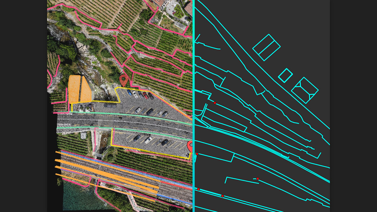
Use the combined power of images and point clouds to extract key elements from photogrammetry, laser scanning or LiDAR data. Survey curbs, building footprints, walls, catenary curves and more. |
Work with small to very large projects. More than one photogrammetry or laser scanning file can be worked on at once, easily. |
Include layers and properties for a smooth transition to CAD or GIS and reduce file size when exporting your projects as vector files. |
Extract key elements in 3D
 |
|
|||
|
||||
|
||||
|
 |
|||
 |
|
Your choice of point cloud
Import projects from Pix4Dmapper, or any .las or .laz file.
 |
  |
|||
|
Aerial data Create a point cloud from images in Pix4Dmapper, and drag and drop the .p4d file to Pix4Dsurvey. |
Laser or LiDAR Pix4Dsurvey works with any point cloud formatted as a .las or .laz file. |